1. Create a report
Start a location-specific record with an automatically assigned report identifier, location, reporter, date, status, and notes.
A structured field-research application for documenting accessibility at real-world locations through predefined assessment categories, ratings, observations, photographs, geographic information, and generated reports.
Developed · Not yet publishedThe Access Report application grew from Gryphon Foundation's broader work in assistive technology and accessibility. It provides a way to record what a researcher encounters at a location, preserve supporting evidence, and organize findings into a report. The application is distinct from the ACCESS Reports video documentary series.
Its documented methodology uses six assessment categories: Parking, Entrance, Customer Service, Seating, Bathrooms, and Views. Each category has predefined questions and rating criteria. The five-point scale describes the accessibility experience; it is not a legal-compliance certification.
Start a location-specific record with an automatically assigned report identifier, location, reporter, date, status, and notes.
Use the predefined questions and rating criteria to document different aspects of the visitor experience.
Attach photographs and written observations to support the assessment.
Document recommendations that may help make a location more accessible.
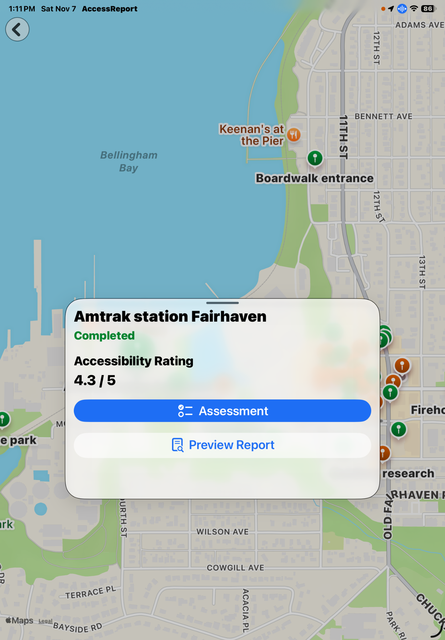
Use geographic information and interactive location pins to open an assessment, begin work, or preview what remains to be assessed.
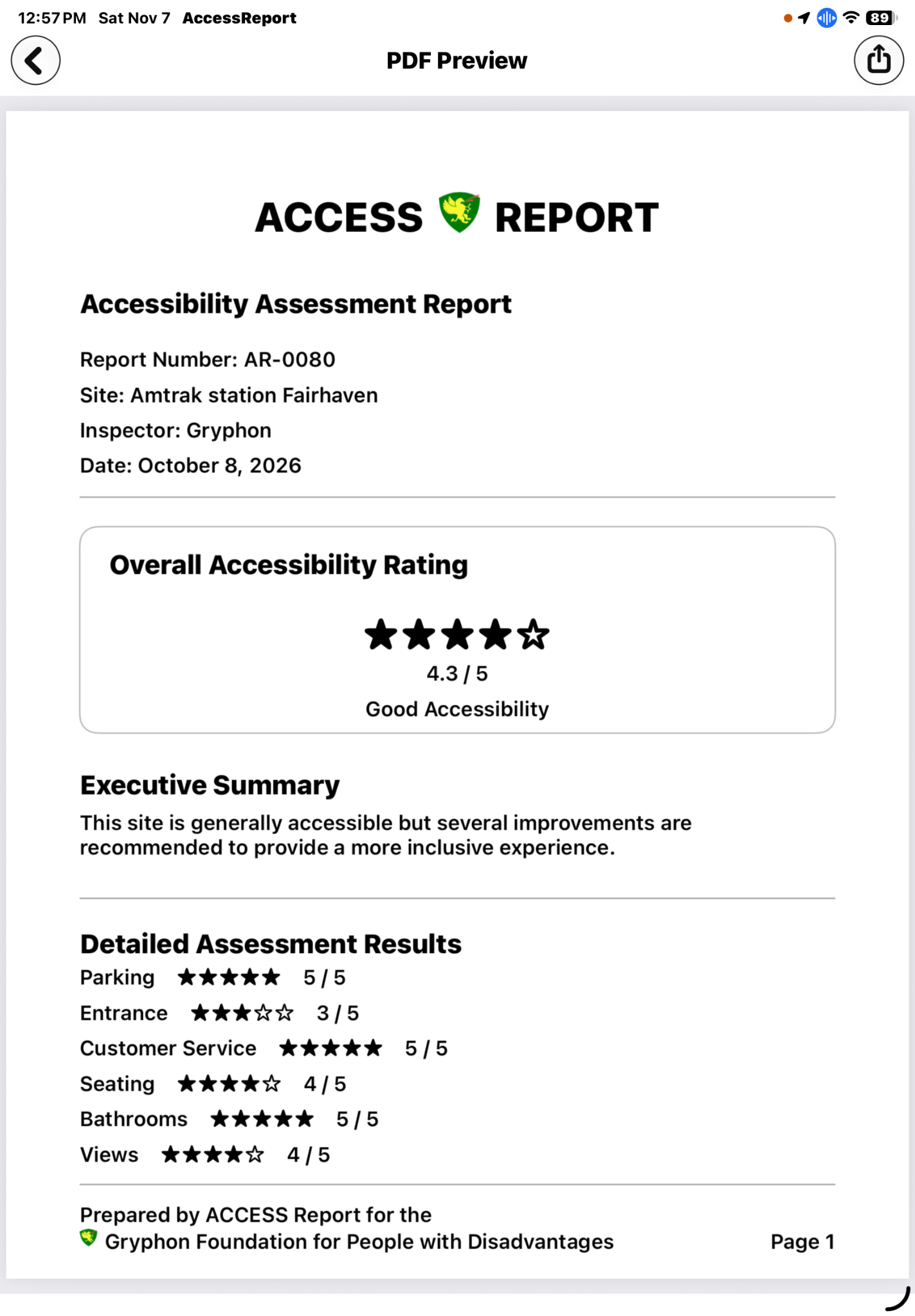
Preview and generate a PDF report that brings together the overall rating, category results, location details, observations, photographs, and recommendations.
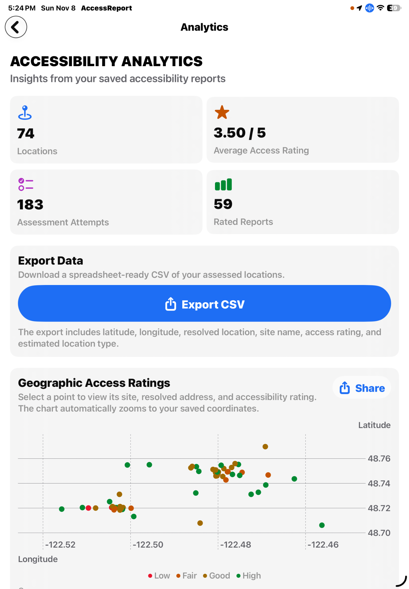
The application now includes an Analytics dashboard that summarizes information from saved accessibility reports. It brings together location coverage, average access ratings, assessment activity, and rated-report counts, then provides several ways to examine and share the results.
Export a spreadsheet-ready CSV containing latitude, longitude, resolved location, site name, access rating, and estimated location type for assessed locations.
Explore report locations on a latitude-and-longitude scatter chart. Ratings are grouped as Low, Fair, Good, or High. Select or drag across a point to inspect a location; the chart zooms to the saved coordinates.
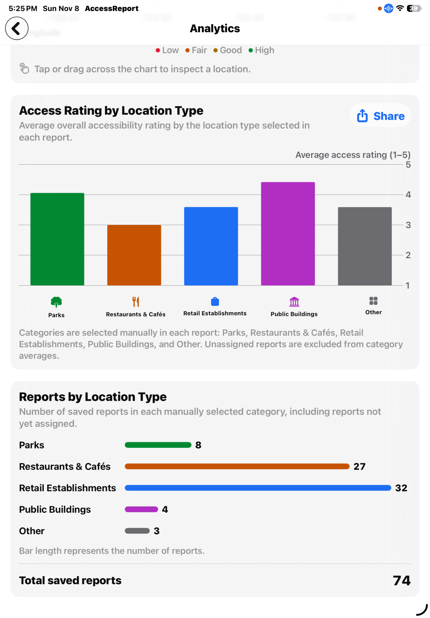
Compare average overall accessibility ratings across Parks, Restaurants & Cafés, Retail Establishments, Public Buildings, and Other. This figure can be shared from the app.
Review the number of saved reports assigned to each location type, with the total saved-report count shown alongside the category breakdown.
These are screenshots of the developed iPad application.
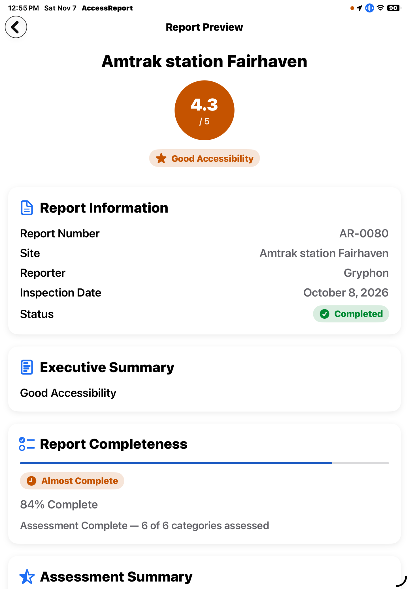
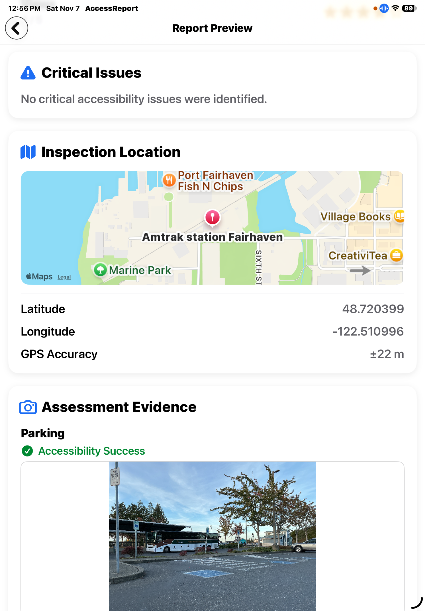
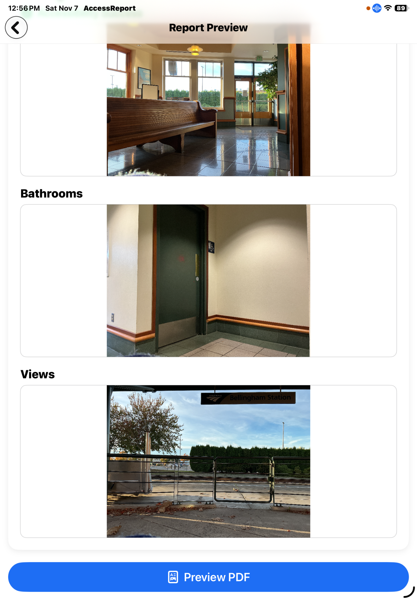
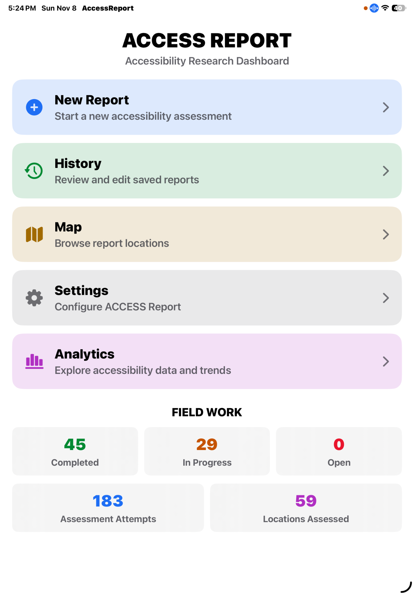
The Analytics dashboard adds CSV export, interactive geographic exploration, a shareable average-rating comparison, and a report-count breakdown.
The ACCESS Report Scientific Field Research Manual documents the assessment protocol, category structure, rating scale, evidence practices, and field workflow. A completed Amtrak Station Fairhaven assessment illustrates how category ratings, observations, photographs, location information, and recommendations are assembled into a nine-page PDF report.
While developing Access Report, Gryphon Foundation recognized that location is also central to social participation. For a person who uses a wheelchair, the accessibility of a meeting place can determine whether a first date is practical. Other people may prefer quiet, familiar, or less stimulating environments.
That insight helped inspire Dating Research: a separate application exploring location-aware discovery, individual meeting preferences, and the development of relationships. The two applications have distinct purposes, but share an interest in how people experience and participate in real-world places.